
Project 2022: Pantheon
- Thread starter Shane
- Start date
You are using an out of date browser. It may not display this or other websites correctly.
You should upgrade or use an alternative browser.
You should upgrade or use an alternative browser.
Register or Login to Hide This Ad for Free!
- Status
- Not open for further replies.
Considering that they will be dredging every 5 years, I would think not.Is there any possibility that the structure in question could be temporary and part of a larger construction project?
Note:Anything I post about Project Madrid is of my own opinion and thoughts, and do not in anyway reflect what @Zachary or @Nicole know or think about the project.
Is there any possibility that the structure in question could be temporary and part of a larger construction project?
Unlikely based on what @Gavin said. Also, there are more temporary things to use in water for short term construction than concrete. Including floating cranes and just sunken base cranes.
Is the only dredge reference that which is associated with the dredge impact area in the sediment basin, as shown on "stitched" detail from the application? Where is the reference to draining the Rhine itself or the 5 year interval? (I'm assuming in the body of the application itself?)
Is the only dredge reference that which is associated with the dredge impact area in the sediment basin, as shown on "stitched" detail from the application? Where is the reference to draining the Rhine itself or the 5 year interval? (I'm assuming in the body of the application itself?)
Are you talking drain as in take out water?
The document doesn’t say exactly where they are dredging, but if the purpose is to create sediment basins, that’s where it’s likely going to happen. And based on my past experiences, regular dredging means they are cleaning out those basins to maintain a certain water depth and or possible harmful runoff.
I was asking about dredging versus draining, but specifically in context of your earlier comment:Are you talking drain as in take out water?
1. I wasn't sure where five years came from, unless it's in the document proper, an assumption of what is in the Rhine BMP based on government guidelines, a reference to the actual BMP (I've never seen their actual BMP for the Rhine), etc. Five years is consistent with what I'd expect for the the sediment basin, I just didn't see where five specifically came from (based on what's been posted thus far)....Everything talked about stays within the boundary of the water. It seems as though its a plan for 4 footers, and a developed way to continually keep the Rhine clear of runoff through dredging every 5 years. Take away what you will about the park needing to continually dredge and area they didn't need to do that with before.
2. The dredge impact area is shown in the sediment basin on the detail diagram linked above, so that's at least one area where the document shows where they're dredging. Keeping that clear on a schedule as per the Rhine BMP or general BMP guidance otherwise makes (i.e. point #1), and by keeping the basin clear, they in turn keep the Rhine clear of excess sediment which would be a goal of their BMP. By referencing dredging in the same statement about the 4 footers however, I wasn't sure whether you were just making two separate points or also saw dredging occurring in the Rhine proper. If so, where is that referenced? (And by Rhine proper, I mean the waterway post-sediment basin construction, as it appears the south shore basin is proposed within what is today water where the swail empties into the Rhine).The document doesn’t say exactly where they are dredging, but if the purpose is to create sediment basins, that’s where it’s likely going to happen. And based on my past experiences, regular dredging means they are cleaning out those basins to maintain a certain water depth and or possible harmful runoff.
Just trying to clarify a few things since I don't have the document and before rumors of Rhine dredging take off, unless of course that is what the document says. FYSA, I'm late to the review party since I was out of pocket last week, but I did drop a note to @Zachary about previously looking for people who have some related professional background...
I was asking about dredging versus draining, but specifically in context of your earlier comment:
1. I wasn't sure where five years came from, unless it's in the document proper, an assumption of what is in the Rhine BMP based on government guidelines, a reference to the actual BMP (I've never seen their actual BMP for the Rhine), etc. Five years is consistent with what I'd expect for the the sediment basin, I just didn't see where five specifically came from (based on what's been posted thus far).
The document specifically says dredging once every five years.
2. The dredge impact area is shown in the sediment basin on the detail diagram linked above, so that's at least one area where the document shows where they're dredging. Keeping that clear on a schedule as per the Rhine BMP or general BMP guidance otherwise makes (i.e. point #1), and by keeping the basin clear, they in turn keep the Rhine clear of excess sediment which would be a goal of their BMP. By referencing dredging in the same statement about the 4 footers however, I wasn't sure whether you were just making two separate points or also saw dredging occurring in the Rhine proper. If so, where is that referenced? (And by Rhine proper, I mean the waterway post-sediment basin construction, as it appears the south shore basin is proposed within what is today water where the swail empties into the Rhine).
Just trying to clarify a few things since I don't have the document and before rumors of Rhine dredging take off, unless of course that is what the document says. FYSA, I'm late to the review party since I was out of pocket last week, but I did drop a note to @Zachary about previously looking for people who have some related professional background...
The document wasn't really clear on where the original dredging will happen. It stated that there were two total amounts, assumed to be the drainage basins.
I was asking about dredging versus draining, but specifically in context of your earlier comment:
1. I wasn't sure where five years came from, unless it's in the document proper, an assumption of what is in the Rhine BMP based on government guidelines, a reference to the actual BMP (I've never seen their actual BMP for the Rhine), etc. Five years is consistent with what I'd expect for the the sediment basin, I just didn't see where five specifically came from (based on what's been posted thus far).
Just for clarity and to avoid some of the confusion. As per the document, the entire Rhine River is considered a BMP. It is referred in multiple locations within the document as "Rhine River BMP". What this means is there is not a separate stand alone BMP dedicated to the Rhine. The proposed basin shown in the @halfabee post is a forebay utilized to intercept sediment, debris and trash before it makes its way into the main lake. It is easier to clean a forebay than the entire lake.
Some of the dredging will occur along the south side in the cove that will house the forebay. Other dredging appears to be small areas to maintain the main channel. And yes, the document states that it is a five year re-occurance.
Perfect, thank you. Yes, I know the Rhine is its own BMP, it's just I have never seen a copy of the document. This isn't the first time the BMP has appeared on documents though (Finnegan's most recently references it as well). And since I don't have this application either, I was "assuming" that it was the that application that specified the best practice of five years to clean out the sediment basin/forebay, and that matches up with the dredge impact area on the diagram...
Does the application mention anything about the channel, or is that an assumption? I would expect the BMP has a reference to the channel already, especially since the cruise operates on the river.
Just trying to interpret the scope of what is in the application (and clarify to avoid confusion)... Thus far, my main takeaways are related to impacts to Festhaus Parkand of a river crossing*, but unless there's more to the application, I can imagine a myriad of possibilities...
* edit: I no longer think this is indicative of a crossing. See later post
Does the application mention anything about the channel, or is that an assumption? I would expect the BMP has a reference to the channel already, especially since the cruise operates on the river.
Just trying to interpret the scope of what is in the application (and clarify to avoid confusion)... Thus far, my main takeaways are related to impacts to Festhaus Park
* edit: I no longer think this is indicative of a crossing. See later post
Last edited:
I spent a few minutes this evening trying to reconcile a few pieces of data from the permitting process...namely, the Chesapeake Bay Preservation Area (CBPA) application that shows the footers of the "attraction," and the recent Joint Permit Application (JPA) filed first with VA Marine Resources Commission for the dredging... As the movie goes, "please excuse the crudity of this model..." Caveats that the plans behind either of both of these of course may have changed since filing.
Red line is simply the 70' contour that I enhanced to try to align the diagrams. Will continue to think through possible ways of reconciling these data...particularly the piles.

Red line is simply the 70' contour that I enhanced to try to align the diagrams. Will continue to think through possible ways of reconciling these data...particularly the piles.

Thank you that is exactly what I asked for earlier in the thread but I suck at Photoshop!
Looks to me like the ride will be interacting with this bridge or whatever it may end up being, which is what I was hoping for.
Looks to me like the ride will be interacting with this bridge or whatever it may end up being, which is what I was hoping for.
I would think that would be highly unlikely, considering the type of piles they're using. Also, if you look at pictures of the existing tressle (below), there is a much longer span length with the truss-style bridge. The footers seem to be too close together for a bridge that could easily span most of the Rhine.What are the odds they are rerouting the railroad?
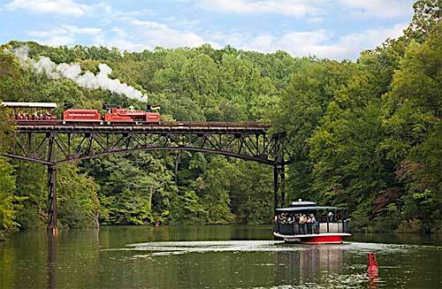
Image: SeaWorld Parks & Entertainment, Inc.
Completely uneducated opinion but I would think thasy the weight of those trains would dictate something other then wood pilings with a cement top.What are the odds they are rerouting the railroad?
Completely uneducated opinion but I would think thasy the weight of those trains would dictate something other then wood pilings with a cement top.
Not to mention turns being too tight.
I didn't get a chance to expand on my thoughts last night given the hour... so here's what I came up with when looking at the diagram:
1. I now highly doubt the structures in the Rhine are for a bridge.
2. The JPA states that the structures, assumingly those in the Rhine as there are separate and inconsistent construction details for the sediment pond, are "Structures to be wood piles capped with concrete."
3. I've worked with a few bridges in the past--and a rail trestle (which already exists not far away--can't think of any reason to move it) or a high pedestrian bridge, really wouldn't use pilings like that as abutments for many reasons (and indeed, neither Ponte de San Marco nor the rail trestle on either side do).
4. What could possibly use such construction would be a pedestrian (not vehicular) bridge low to the water (like the one by Nessie). However, numerous issues with that: a) the Rhine cruise, b) the very steep slopes on either side of the Rhine complicating sediment control and accessibility issues, c) the fact that when you egress the bridge on the north bank, you are walking literally into the Madrid attraction (as then conceived), d) and who knows what happens on the south bank--the sediment basin only tells me they may wish to develop Festhaus Park more in the future--not that it has anything to do with Madrid necessarily, e) and that according to the Madrid layout in the CBPA filing, it appears the vegetation between the attraction and the Rhine is being impacted only to allow safe clearance of the attraction, etc. (you'll see where they drew the tree line on that diagram--and if they intended to clear the bank for other projects like access to a bridge, it's material to the CBPA and thus they may have wanted to include it then).
So what fairly low load bearing and low to the water application would concrete topped wood piling structures serve if not a bridge?
My "theory" now is that it is somehow for themeing of the Madrid attraction. I can't really theorize exactly how yet, and it is perpendicular to what appears to be the "track" path of the attraction. Maybe illuminating Madrid over the Rhine, especially the high point of the attraction, which is roughly at the top of the swale just inside the redacted area? We know JCC has some issues with lighting, but if they are "minimizing lighting on the attraction above 60 feet" in a way that focuses on the "lattice" like construction that doesn't conflict with the waiver? Maybe it is for water cannons like Maverick? Maverick's I'm pretty sure are below the water line, but with boat traffic, it's probably best to mount those on concrete pads on concrete piers--or perhaps wooden piles driven into the lake bed. Arguably, such theming "in" the Rhine would be much easier than on the vegetated steep north slope of the Rhine.
edit: Looking at the scale on the JPA diagram, there's plenty of navigable channel water in between impact areas 3 & 4 for the cruise. I really think these pads are for mounting something, not for a crossing.
Last edited:
My "theory" now is that it is somehow for themeing of the Madrid attraction.
This is exactly what I thought when I first saw the data.
I didn't get a chance to expand on my thoughts last night given the hour... so here's what I came up with when looking at the diagram:
1. I now highly doubt the structures in the Rhine are for a bridge.
2. The JPA states that the structures, assumingly those in the Rhine as there are separate and inconsistent construction details for the sediment pond, are "Structures to be wood piles capped with concrete."
3. I've worked with a few bridges in the past--and a rail trestle (which already exists not far away--can't think of any reason to move it) or a high pedestrian bridge, really wouldn't use pilings like that as abutments for many reasons (and indeed, neither Ponte de San Marco nor the rail trestle on either side do).
4. What could possibly use such construction would be a pedestrian (not vehicular) bridge low to the water (like the one by Nessie). However, numerous issues with that: a) the Rhine cruise, b) the very steep slopes on either side of the Rhine complicating sediment control and accessibility issues, c) the fact that when you egress the bridge on the north bank, you are walking literally into the Madrid attraction (as then conceived), d) and who knows what happens on the south bank--the sediment basin only tells me they may wish to develop Festhaus Park more in the future--not that it has anything to do with Madrid necessarily, e) and that according to the Madrid layout in the CBPA filing, it appears the vegetation between the attraction and the Rhine is being impacted only to allow safe clearance of the attraction, etc. (you'll see where they drew the tree line on that diagram--and if they intended to clear the bank for other projects like access to a bridge, it's material to the CBPA and thus they may have wanted to include it then).
So what fairly low load bearing and low to the water application would concrete topped wood piling structures serve if not a bridge?
My "theory" now is that it is somehow for themeing of the Madrid attraction. I can't really theorize exactly how yet, and it is perpendicular to what appears to be the "track" path of the attraction. Maybe illuminating Madrid over the Rhine, especially the high point of the attraction, which is roughly at the top of the swale just inside the redacted area? We know JCC has some issues with lighting, but if they are "minimizing lighting on the attraction above 60 feet" in a way that focuses on the "lattice" like construction that doesn't conflict with the waiver? Maybe it is for water cannons like Maverick? Maverick's I'm pretty sure are below the water line, but with boat traffic, it's probably best to mount those on concrete pads on concrete piers--or perhaps wooden piles driven into the lake bed. Arguably, such theming "in" the Rhine would be much easier than on the vegetated steep north slope of the Rhine.
edit: Looking at the scale on the JPA diagram, there's plenty of navigable channel water in between impact areas 3 & 4 for the cruise. I really think these pads are for mounting something, not for a crossing.
FWIW, Cement/Stone capped logs is how the Brooklyn Bridge was built.
FWIW, Cement/Stone capped logs is how the Brooklyn Bridge was built.
Standards of construction have come a long way since the 1880s...
")
I sincerely doubt we're looking at a bridge.
Just taking a wild stab, could such a "bridge" be for utilities? As I've read, there are issues with power in the park. Maybe the Festa side is close to peak usage. So, perhaps, this could be the most economically way to bring power from the Drachen Fire "area" to the Madrid area.
- Status
- Not open for further replies.
Share:
Consider Donating to Hide This Ad